Expert hiking behind the Glacier des MinesExpert hiking behind the Glacier des Mines
©Expert hiking behind the Glacier des Mines|ANDRE David

Haute Route Glaciaire hike

Travel the Haute Route Glaciaire for four days, with wild & infinite nature as your playground.

The Sainte-Foy area offers a multitude of marked trails to discover the sumptuously varied landscapes of the Haute-Tarentaise. It’s a real opportunity for long-distance hikers to reconnect with nature, and the promise of a successful mountain experience.

If you had to choose just one, look no further: the Haute Route Glaciaire is the ultimate itinerant adventure. Discover four days in four stages between Tarentaise and Val d’Aoste in Italy.

Step 1 From the Chenal to the Archeboc refuge

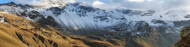
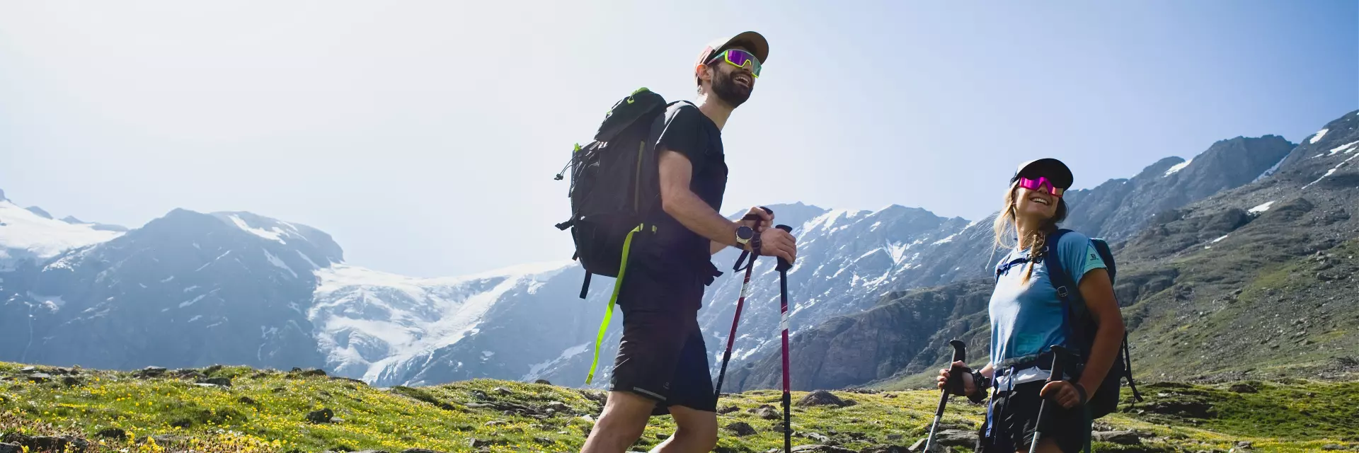
Departure from the hamlet of Le Chenal (alt. 1700m) for four days of adventure, and after just a few minutes’ walk you’re already crossing the listed village of Le Monal. Beyond its authentic architecture in the heart of pastures and majestic larches, a breathtaking panorama of the Mont Pourri massif and its glaciers awaits you.

After that, you head for the resort, which you’ll have to cross to take a beautiful track between meadows and forests towards Le Planay Dessus, where you’ll also find a breathtaking view of the Haute-Tarentaise.

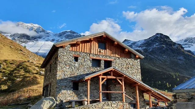
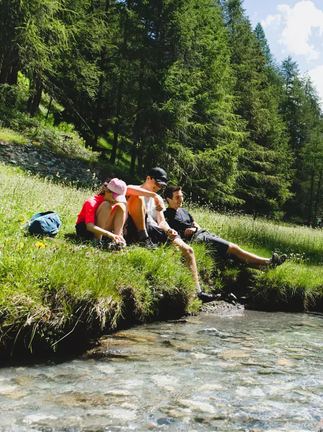
You then enter the forest once more, and after a short sheltered stretch, discover the Mercuel valley , at the end of which a warm welcome awaits you at the Refuge de l’Archeboc (2029 m).

  • Access

    From Sainte-Foy La Thuile, head towards Tignes for 5 minutes, then take the Route du Chenal on the left at the Pigettes paravalanche. Park at the Chenal parking lot, the highest point accessible by car.
    Please note that the parking lot fills up very quickly during the tourist season.

  • Practical info

    From the hamlet of Chenal to the Refuge de l’Archeboc :

    • Distance: 14.5km
    • Difference in altitude: +800m D+ (+800m)
    • Walking time (excluding breaks): 4h30

    Véronique will be delighted to welcome you to the Refuge de l’Archeboc. For reservations, please contact her

    • +33 (0)6 76 85 24 56 or +33 (0)4 79 06 87 19
    • veronique.emprin021@orange.fr
  • Our advice

    For all these hikes, you’ll need the IGN map: Ref. 3532ET, 3532ETR.

    Even in summer, be vigilant and plan for an early start.
    Make sure you always leave with a minimum of provisions and warm clothing, as the weather can deteriorate from one moment to the next.

    To preserve the sites and ecosystems you cross, always collect your garbage.

Step 2 From the Archeboc refuge to the Epée refuge

For your second day of adventure, set off on a stage steeped in history, with a route that has seen military troops pass through for centuries :

  • military troops during confrontations
  • peddlers (the path from Mazure to Col du Mont was classified in 1692 as a “Grand chemin tendant en Valgrisenche”)
  • pilgrims (every August 5, the procession to Lac San Grata commemorates the clandestine return of the Saint’s relics via the Col de la Sachère).

History aside, you’ll also be amazed by the beauty of the scenery, with breathtaking views of Lac San Grata and Lac Di Beauregard, before making the final ascent to Chalet de l’Epée at 2370m.

  • Practical info

    From the Archeboc refuge to the Chalet de l’Epée :

    • Distance: 13.5km
    • Difference in altitude: +1150m D+ climb
    • Walking time (excluding breaks): 3h10

    Chalet de l’Epée contact:

Step 3 From the Chalet de l'Epée refuge to the Mario Bezzi refuge

After two days of intense hiking, there’s nothing like stage 3 to lighten your legs on the extraordinary balcony suspended above the Valgrisenche torrent valley. Appreciate the high mountains in a dream setting, with the backdrop of the Ruitor and Grande Sassière massifs and the border range crossed the day before.

For the more sporty, we suggest a climb to Lake San Martino (2700 m), (allow 1h30 round trip for this option) before reaching the Refuge Mario Bezzi (2284m) and enjoying typical cuisine.

  • Practical info

    From the Chalet de l’Epée refuge to the Mario Bezzi refuge:

    • Distance: 8.6km
    • Difference in altitude: +435m D+ climb
    • Walking time (excluding breaks): 3h10

    Refuge Mario Bezzi contact:

Step 4 From the Mario Bezzi refuge to the Chenal parking lot

The last day takes you straight up to the Col de Rocher Blanc before unveiling the sumptuous vallon de Clou, a listed site since 2013. From the top of this majestic vista, let yourself be carried on a long descent back to your original starting point. Crossing the entire valley, you pass through the ancestral hamlet of Les Balmes and its alpine pastures used to make Beaufort cheese, which you can taste and take away with you a few kilometers further on, stopping off at the village of Le Monal.

  • Practical info

    From the Mario Bezzi refuge to the Parking du Chenal :

    • Distance: 13.5km
    • Ascent: +615km D+ (ascent and descent)
    • Walking time (excluding breaks): 4h15