Description
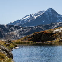
From the Pierre Giret parking lot, follow/climb the tarred road for 100m, and after the Savonne bridge, take the path that rises to the left along the torrent. After about 15 minutes, turn right onto the Sassière path. Join the pastoral road of la Sassière and follow it to the plateau. Go forward on the plateau for several hundred meters. The Refuge is well in sight on the plateau. After the refuge, 300 m further on, cross the stream on a small footbridge, continue on the left bank of the stream, until you reach a chaos of huge rocks. Then cross the stream again on a natural bridge and follow an almost flat track on your left, sometimes not very visible. Cross several small streams. Finally a small corridor leads to the Longet lake. Leave it on the left and take a couloir for 20 minutes which leads to the Verdet lake. Same route for the return.
Information
Address
73640 Sainte-Foy-TarentaiseWebsite
E-mail address
Phone
Animals
AcceptedOpening
Might be accessible only between June and November.
Subject to favourable snow and weather conditions.
Services
Type of customer
- Level red – hard
Services
- Pets welcome
To see also
More
hiking trail: tête du plane
Selected among the "best walks in Tarentaise". Easy walk, with beautiful views of the Petite Sassière massif.
A digital and paper version of the walking map is available at the Tourist Office of the resort.
More
hinking trail : the lac du petit
Magnificent hike lost in a cirque, along a stream with rhododendrons in spring or summer. Very beautiful panorama on the Mont Pourri and the glaciers.
Map available in paper and digital version at the Tourist Office of the resort.
More
mountain refuge of le ruitor
Located in the valley of the Petite Sassière, the refuge is guarded in spring and summer. The rest of the year the refuge is open but there is no surveillance. On-site catering during the opening period: fresh and local produce.