Description
From the P6 car park, continue along the flat road towards Le Miroir. After the bridge, turn right up a steep path with a few steps through the village of Le Miroir. At the top, turn right onto the path towards Le Crôt. Cross the torrent, join the tarmac road and follow it up to the Plan du Pré. Turn right onto the path leading into the forest and continue along it until you reach the forest road. Take this road upwards, then at the second bend, follow the path down towards Planay- Dessous. Enter the village, go down an alley and, in front of the pond, go down the winding path that crosses the hamlets of La Croix and Pravarnier. Below Pravarnier, take the tarmac road at the bend, walk down it for 50 m and take the path opposite which descends to the house of Plan de Suel. Then take the wide path on the right that leads to La Mazure.
Information
Address
Parking de la MazureChef-Lieu
73640 Sainte-Foy-Tarentaise
France
Website
E-mail address
Phone
Animals
AcceptedOpening
From 02/05 to 30/11.
Subject to favorable snow and weather conditions.
Rates
Free access.
Services
Type of customer
- Walkers/hikers
- Level red – hard
Services
- Pets welcome
To see also
More
hiking trail : the falconnière
Starting from the hamlet of le Miroir, a pretty path in the forest with steep slopes. View over the whole of the upper Isère valley.
Map available in digital and paper version at the Tourist Office of the resort.
More
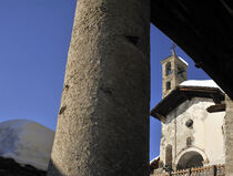
the hamlets of le miroir and la masure and the chapelle ste brigide
These two protected hamlets testify to the work of the Piedmontese masons who came in the 18th century. to build these houses with columns of stones. Chapel Ste-Brigide is registered with the Historical Monuments. Magnificent panorama on the glaciers of Mont Pourri.

