Description
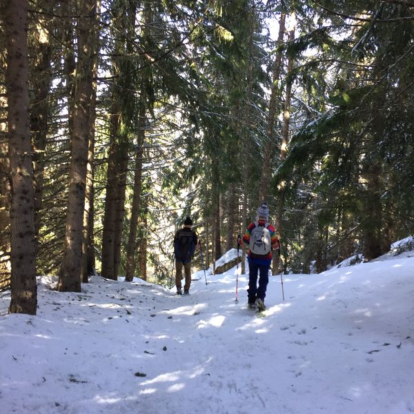
Snowshoeing itinerary marked out from the Notre Dame de Bonconseil chapel. This circuit allows you to reach the top of the Plan Bois chairlift, where there are 2 high altitude restaurants.
Map available at the Tourist Office.
Information
Address
Station73640 Sainte-Foy-Tarentaise
Website
E-mail address
Phone
Opening
From 01/11 to 30/04.
Subject to snow conditions.
Services

To see also
More
itinerary for snowshoeing : bonconseil
A moderately difficult route marked out from the resort (Bonconseil sector). A very nice itinerary for a walk in the forest.
Map available at the Tourist Office.
More
itinerary for snowshoeing : le planay
Snowshoe itinerary starting from the resort (Notre Dame de Bonconseil chapel). This marked out circuit allows you to reach the hamlet of Planay Dessus from where you will have an incredible view of the mountains and the valley.
Map available at the Tourist Office.
More
itinerary for snowshoeing : mazure - miroir
Snowshoe itinerary starting from the hamlet of La Mazure (shuttle bus stop). This marked out circuit allows you to visit the typical hamlets of La Mazure and Le Miroir while discovering a forest trail.
Map available at the Tourist Office.
More
itinerary for snowshoeing : montalbert
Moderate difficulty itinerary marked out from the resort (Bataillette sector). Very nice itinerary to reach the charming hamlet of Montalbert.
Map available at the Tourist Office.
More
itinerary for snowshoeing : saint guerin
Itinerary of high difficulty and marked out from the resort (Notre-Dame-de-Bonconseil chapel). Very nice itinerary to reach the St Guérin chapel, just above the Marquise chairlift.
Map available at the Tourist Office.
More
itinerary for snowshoeing: la mazure (black)
Snowshoe itinerary starting from the resort. This signposted route takes you through the forest to the charming hamlet of La Mazure. You can return by shuttle bus.
Map available at the Tourist Office.
More
itinerary for snowshoeing: the drains
Itinerary marked out from the resort with a panoramic view of Mont Pourri, Le Thuria and the Aiguille Rouge. A good part of this route is in the forest.
Map available at the Tourist Office